skip to main
|
skip to sidebar
darbymcsexton
Friday, January 23, 2009
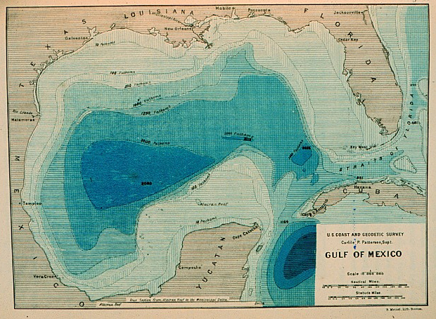
Bathymetric Map
A bathymetric map is a type of topographic or contour map that shows sea floor elevations. This is a map of the floor of the Gulf of Mexico.
http://celebrating200years.noaa.gov/events/survey/gulf_of_mexico650.jpg
No comments:
Post a Comment
Newer Post
Older Post
Home
Subscribe to:
Post Comments (Atom)
Blog Archive
▼
2009
(41)
►
April
(35)
▼
January
(6)
DOQQ
Box Plot
Bathymetric Map
Topographic Map
Dot Density/Distribution Map
yay i figured this out
About Me
darby mcneill sexton
I'm 23 years old. I have a beautiful little boy named Marcus and wonderful husband, Chris.
View my complete profile
How do you rate this collection of maps?
Followers

No comments:
Post a Comment